Brighton District Map
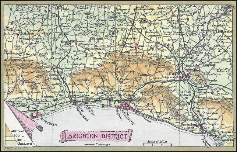
This postcard shows a map of the Brighton District of Sussex, England. This was one of my earliest purchases and ticks many boxes for me.
It shows an area very familiar to me, albeit from probably 60 to 70 years before I was born. Many of the places on the map have a personal connection to me, my family and many of my ancestors.
It also illustrates many of the places that feature in my postcard collection, so you can expect to recognise the names of these places in the coming months and years.
One of my other interests is old maps, normally I would go for a larger scale map (I’m big fan of Ordnance Survey maps) but it is great when postcard collecting intersects with one of my other hobbies.
As you can see this postcard was part of the Wrench Series, published by Wrench Postcards Ltd. It was postally unused but probably dates from between 1902 and 1906.